Whittle Pike Race
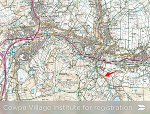
From – Cowpe Village Hall near Waterfoot, Rossendale GR 837212
Cost – Online entry vis Si Entries for 2025
Start time – 11.00 am. Women’s race 12.00 pm
Whittle Pike fell race 2025.
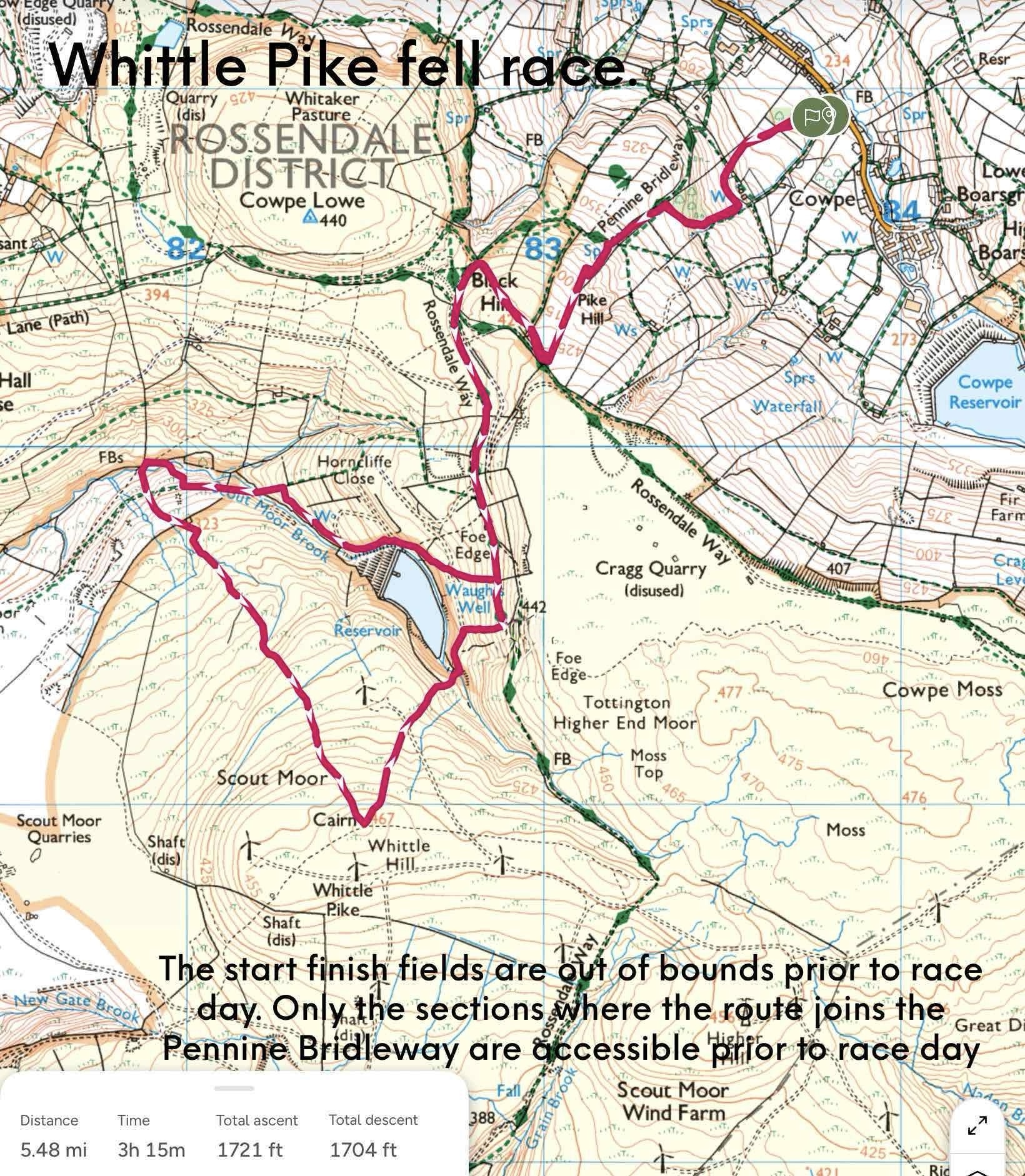
30 Aug 2025 AS. Amended route map below
9.8k 550m of climb
Open race 11.00. Women’s 12.00. Revised course so new records.
RO. Nick Harris nick.harris@northmanchester.net 07956344174
You will need to collect your SI dibber from the hall.
Pay for refreshments at the hall and we plan to have a coffee van available.
Toilets in the hall and porta loos next to the hall.
There will be small parking charge so please car share. No parking on Cowpe Road.
Follow signs to park a. on the Greenbridge car park (free for early arrivals b. ex Buck car park, registration is further up the road on your right for both these parking areas and c. behind the nearby recreation ground which you then cross to get to the hall – there will be a small charge for the latter 2 car parks. The start/finish will be off the lane beside the hall. The start/finish area is about 200m from registration.
Waterfoot, 800ms away, has the Coop, garages and EV charging in car parks.
The first section is uphill through two fields exiting past sheep folds and turning left onto the Pennine Bridleway and then veering left to climb to the top of Pike hill, 90deg right turn at Pike hill and a grassy decent to the gate at the top of the Pennine Bridleway. Left turn at the gate and on to a level section both grass and then hard surface past Fo(e) edge ruin, the name of another club race, for about 1 k. At a small gate you will turn right and descend.
You will return to this point and reverse the course back to the finish.
The route downhill follows the edge of a reservoir and Scout Moor Brook for nearly 1k, left over a FP stile and the brook, a sharp climb up to a quarry tram way going right and level for 400m, right onto a steep descent and recross the brook and onto the concrete bridge where you go left.
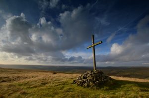
Here you start the long climb, rutted at first which is the reverse of the Edenfield race descent. A long slog for 1.5 k, boggy in places. 200m climb. The top, Whittle 467m has a large cross on top.
Left turn and descend back to the culverted stream above the reservoir. This is the only section left from the 1993 route. Left through a gate and, after 200 ms, right into a stiff 50m climb on rough ground and then you re-join the outward route after a left turn past Waugh’s well.
The route will take you back up and over Pike hill before the descent with the last 200ms being a variation on the start climb.
We hope you enjoy the race. Nick Harris
New route for 2025
https://www.strava.com/routes/3387428826658485060
Details: Nick Harris
Tel:07956 344174
nick.harris@northmanchester.net
Results 2016 WhittlePikeResults
Results 2017 WhittlePikeResults
Results 2018 WhittlePikeResults
Results 2019 WhittlePikeResults
Results 2021 whittle pike results 2021
Results 2022 whittle pike 2022 results
Results 2023 whittle pike results 23
Results 2024 Whittle Pike Senior 2024